Songhees Walkway Pocket Beach
Green Shores Demonstration Site
2025 Update
The Songhees Walkway Pocket Beach Enhancement Project restored a popular and highly modified urban shoreline located just southeast of Lime Bay Park in Victoria Harbour to a forage fish pocket beach habitat. The project area is less than 0.1 ha encompassing 40m of upper intertidal shoreline with a 10m wide backshore area.
The project is located on the north shore of Victoria’s middle harbour within the traditional territory of the lək̓ʷəŋən (Lekwungen) People, known today as the Songhees Nation and Esquimalt Nation. The pocket beach serves as a Green Shores demonstration site as part of the Resilient Coasts for Salmon program administered by the Pacific Salmon Foundation in partnership with the Stewardship Centre for BC.
Restoration was Completed in Two Phases
The project was constructed in two phases made possible by Peninsula Streams Society, Pacific Salmon Foundation, Stewardship Centre for BC, City of Victoria, Songhees Nation, Esquimalt Nation, Salish Sea Industrial Services, Destination Greater Victoria, Satinflower Native Plants, Ralmax Group of Companies, and Coastal Geologic Services Inc.
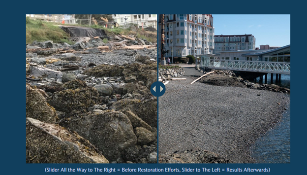
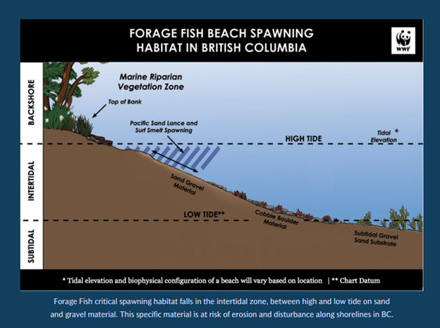
Pre-restoration conditions included debris and rip-rap armouring material in the upper beach and anthropogenic fill in the backshore. Phase I was completed in 2022 and included the removal of riprap, concrete and other anthropogenic non-native materials from the shoreline and below the natural boundary. A salvage survey was completed for any species at risk and relocated gunnels, crabs, and shellfish species. With cultural and environmental monitors on site, the beach was regraded, and sill was added to the toe of the beach and backfilled with a washed alluvial sand and gravel mixture suitable for forage fish spawning like the native sand lance and surf smelt. Within three weeks of completing Phase I, surf smelt eggs were detected on the restored beach!
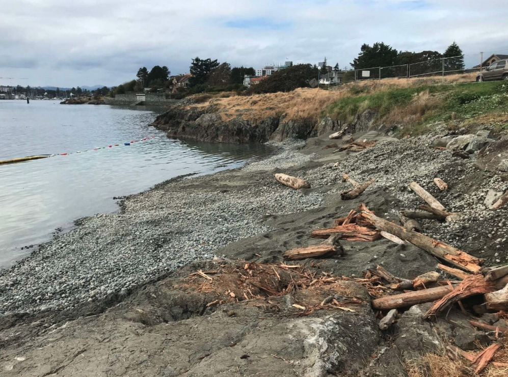
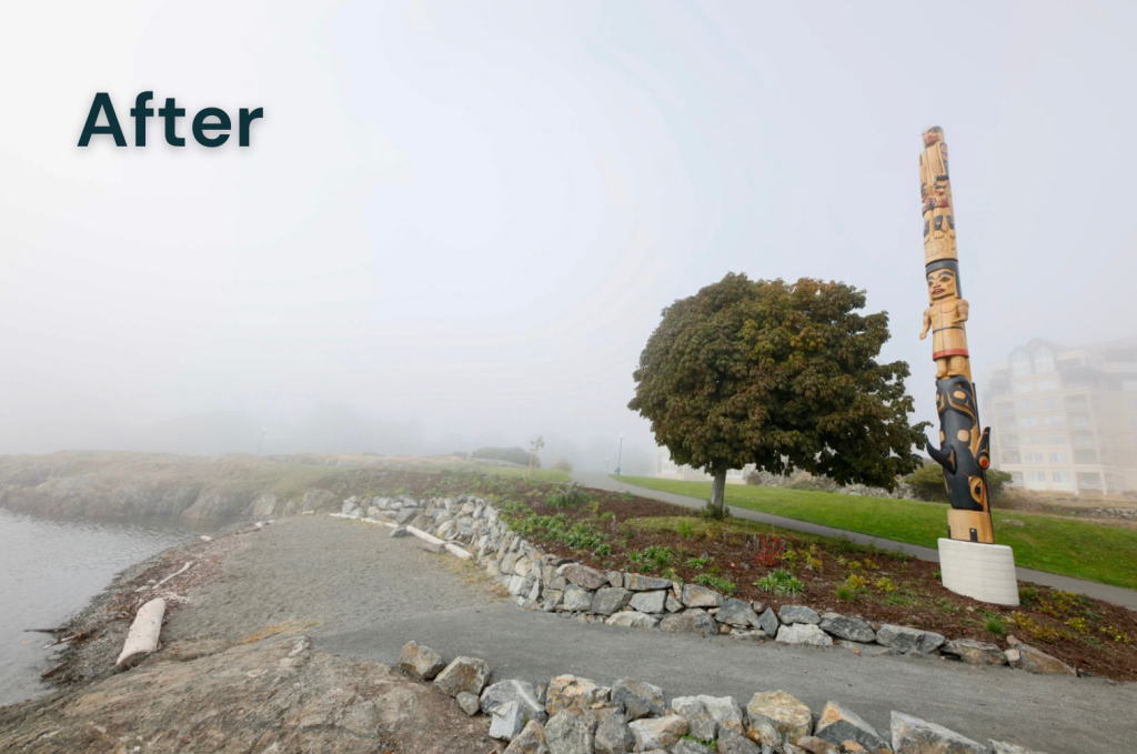
Project site following completion of Phase I beach nourishment in late 2022. Photo Credit: Peninsula Streams Society.
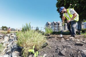
Phase II was completed in 2023, which focused on the upper area of the project and adding finishing touches to the pocket beach. The backshore was excavated to provide more beach habitat, and a rock wall was constructed to protect upland archaeological deposits. Invasive species found in the backshore were removed and the area was replanted with native marine riparian vegetation that will be resilient to climate change and provide valuable food and habitat for wildlife. Public access to the beach was redirected to a designated pathway to encourage public use of the pocket beach while protecting the recently restore riparian area from foot traffic.
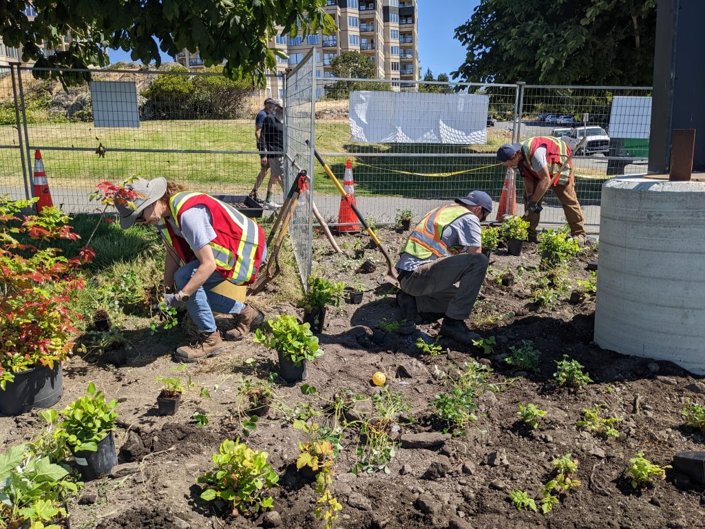
Project team and volunteers plant the backshore with native marine riparian vegetation at the Songhees Walkway Pocket Beach in Summer 2023. Photo Credit: Peninsula Streams Society.
Restoration Benefits and Outcomes
The Songhees Walkway pocket beach once hosted a vibrant marine ecosystem plentiful with kelp forests, shellfish, eelgrass meadows, and forage fish spawning habitat; it also served as a perfect sheltered shoreline for launching and landing area for traditional watercraft like the Western redcedar dugout canoes. Since completing construction in 2023, the pocket beach has accomplished all its objectives and has been used for its core intended purposes – as forage fish spawning habitat and a landing for cultural canoes. A Traditional Welcome Pole that was raised in 2023 and carved by Tom LaFortune now overlooks the enhanced pocket beach. The project will undergo long-term monitoring to understand how the Green Shores design is performing and what wildlife and species are utilizing it.

The completed Green Shores demonstration project at the Songhees Walkway Pocket Beach. A Traditional Welcome Pole carved by Tom LaFortune was raised upon project completion in 2023, overlooking the newly enhanced pocket beach. Photo Credit: Ken Barnes, Salish Eye Productions.
StoryMaps Feature of the Project
The University of Victoria Community Mapping Students Jamesa Ensing, Syd Hall, Tate Litherland and Marc Smith produced an interactive page on the StoryMaps ArcGIS platform to highlight the history of the area and the importance and application of nature-based restoration on this site. The StoryMap also features jurisdictional complexity associated with shoreline ownership, permits and rights and how this project contributed to sustainability, and addressed threats associated with climate change and habitat loss. This StoryMap is an engaging way to learn about the project and different perspectives – from local to provincial and global scale.


Next Steps
The final phase of the project will include two steps. The first step will be the installation of educational signage in 2025 to increase public awareness of nature-based solutions like Green Shores used in this project, the importance of healthy shoreline habitat, and the cultural history of this landscape. The second step will be to continue long-term monitoring of the site enhancements, performance, and biodiversity; this will help inform future restoration projects and the efficacy of nature-based approaches like Green Shores. To learn more about this project, visit the Peninsula Streams and Shorelines website.